-
- About Us
-
Our Services
-
Other Offices
Ministry/Division & Department
- e-Services
- Gallery
-
Contact
যোগাযোগ ম্যাপ
Communication Map
- Opinion and Suggestion
-
- dashboard
-
- About Us
-
Our Services
Office Order/Notice
Training & Suggestions
পরিদর্শন প্রতিবেদন
Performance Agreement (23-24)
Purchase Plan 2022-23
APP-2024-25
Duties of Settlement Office Officers and Employees
-
Other Offices
District/Upazila Offices
Ministry/Division & Department
- e-Services
-
Gallery
Photo Gallery
Video Gallery
Forms
00
Rules
national anthem
-
Contact
যোগাযোগ ম্যাপ
Communication Map
-
Opinion and Suggestion
Give your opinion
-
-
dashboard
Officer/Employee Information
One of the longest rivers in the world. Its catchment area covers large areas of China (Tibet), India and Bangladesh. It originates from the Shimayang-Dang Glacier, a place (31°30´N and 82°0´E) about 145 km from Parkha. Parkha, an important trading center between Lake Manas Sarovar and Mount Kailash. The river traverses a long stretch of dry and flat areas of southern Tibet and is blocked near the 'Namcha Barwa' peak of the Himalayas. Its height is 7,755 meters. Its main tributaries in Indian territory are Amochu, Reidak, Sankosh, Manas, Vareli, Dibang and Luhit. Several tributaries of the Tibetan Plateau originate partly from the region between the main Himalayas and the Zangpo. The total length of the Brahmaputra from its source in southwestern Tibet is 2850 km.
Brahmaputra is known as Dihang in the Himalayan region of Assam. Brahmaputra is known by that name until it enters the vast plains of East Bengal. It meets the Dibang and Luhit on the east near a place called Sadaiya in northeastern Assam. The Dibang tributary drains the eastern Himalayan drainage system of the Dihang and the Luhit region between Assam and Myanmar.
The course of the Brahmaputra through the Tibetan plain is known as the Zangpo, and south of Lhasa its course slows down. From its source near Namcha Barwa to its entrance in the central Himalayan region, the river has a total length of 1600 km in Tibetan territory. Three tributaries join the river in Tibet. Its base land elevation is 4,523 m at Tradam, 2,440 m at Geila Sindong near Namcha Barwa, and only 135 m at Sadaiya in northeastern Assam. In Assam it flows from south-west of Bandhu to north of Shillong Pass before entering Bangladesh.
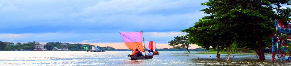
Brahmaputra is a large river in the plains of Assam. The river has numerous islands and changes its course frequently. After traversing a transversal course of 720 km in the Assam Valley, it flows around the Garo Hills and enters Bangladesh, and its southward flow length is about 240 km to east of Mela in the Ganges and the South Sea. Its flow in Bangladesh is very short, known as Old Brahmaputra. In fact, the Brahmaputra flowed through Mymensingh district in a south-easterly direction. This is how the course of the river was marked on Rennell's map made in 1785 AD. At the beginning of the 19th century, the elevation of its base increased due to the geostructural upheaval of the Madhupur plain. The entire lower Brahmaputra consists of a network of tributaries, which remain dry during the winter season but flood during the monsoon season. It has numerous islands locally known as Char. This river system flowing in north-south direction is the widest in the country. The Brahmaputra meets the Ganges at Gowalandghat.
The area affected by this huge river is 5,83,000 sq km, of which 47,000 sq km is located in Bangladesh. The river in the interior of Bangladesh is braided. Its four major tributaries are Dudhkumar, Dharla, Teesta and Karatoa-Atrai tract. The first three rivers are drought prone. They originate from steep catchment areas on the south side of the Himalayas between Darjeeling, India and Bhutan. Among all the branches of the Brahmaputra, the Old Brahmaputra is the largest, which was the course of the present Brahmaputra 200 years ago. After a severe earthquake and catastrophic flood in 1787, the course of the river changed.


Planning and Implementation: Cabinet Division, A2I, BCC, DoICT and BASIS
Technical Assistance:
![]()
Developed By: